Top Worst Earthquakes
Top Worst Earthquakes in history From devastating tsunamis to unprecedented magnitudes, explore the impact and aftermath of these seismic events
Aditya Pandey

Top Worst Earthquakes in history From devastating tsunamis to unprecedented magnitudes, explore the impact and aftermath of these seismic events

Earthquakes, the result of tectonic plates colliding and releasing built-up stress, have shaped the Earth's landscape and, at times, left indelible marks on human history. From ancient civilizations to the modern era, these seismic events have caused widespread destruction and loss of life. In this article, we explore the Top 10 worst earthquakes in recorded history, each leaving an enduring impact on the affected regions and reshaping our understanding of the Earth's dynamic forces.
Earthquakes, while natural phenomena driven by tectonic activity, have the potential to unleash devastating consequences on human populations. The top 10 worst earthquakes in recorded history serve as stark reminders of the Earth's dynamic nature and the need for preparedness and resilience in the face of such powerful forces. As technology and awareness continue to advance, understanding and mitigating the impact of earthquakes remain crucial for the safety and well-being of communities worldwide.
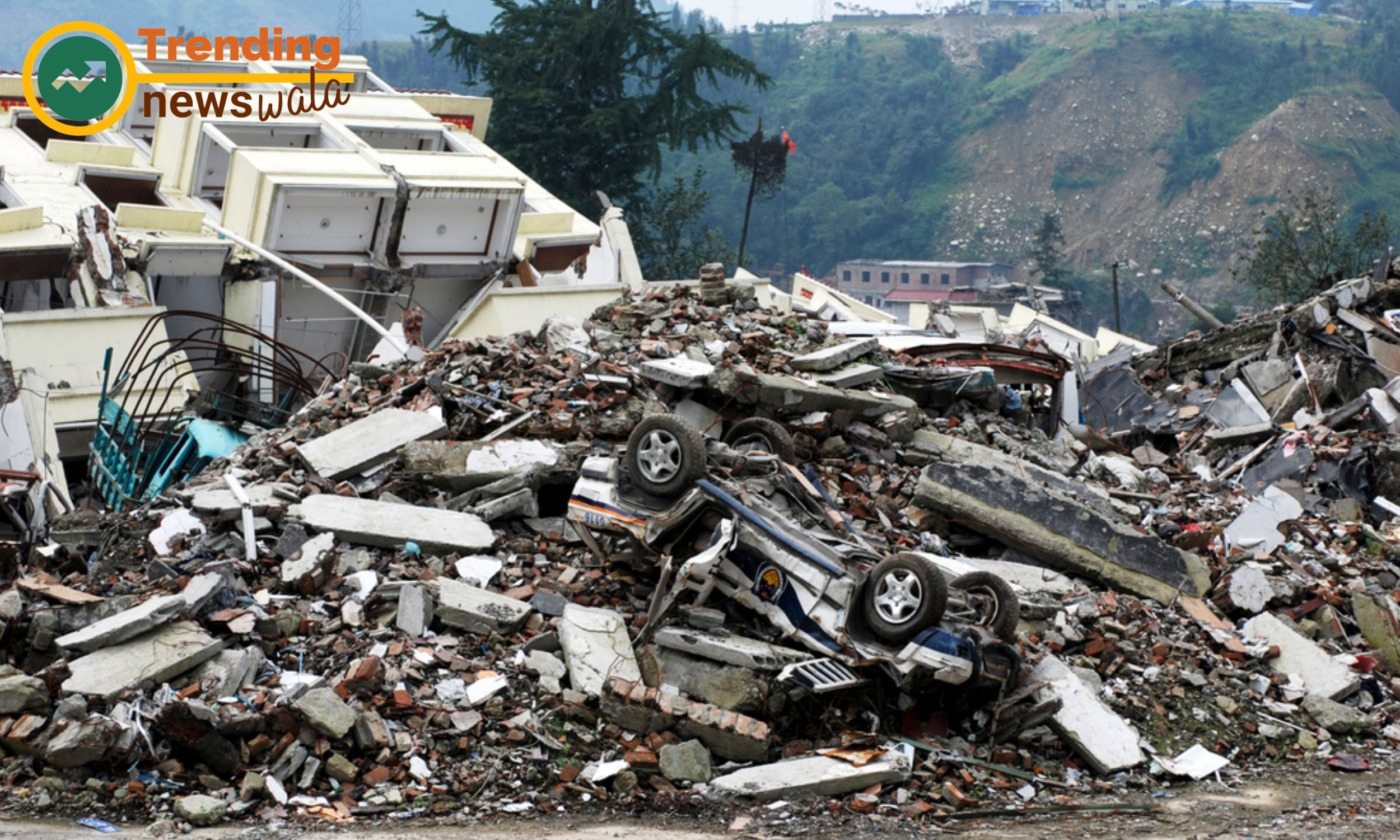
The 1556 Shaanxi earthquake struck
Known as the deadliest earthquake in recorded history, the 1556 Shaanxi earthquake struck the Shaanxi province in China, claiming an estimated 830,000 lives. The magnitude 8.0 earthquake devastated an area of approximately 520 miles, altering the course of rivers and toppling buildings.
In the annals of seismic history, the 1556 Shaanxi earthquake stands out as one of the deadliest natural disasters ever recorded. Striking the Shaanxi province in China, this catastrophic event left an indelible mark on the landscape and the collective memory of the affected region. In this article, we delve into the details of the 1556 Shaanxi earthquake, exploring its impact, historical context, and enduring legacy.
Historical Context: The 16th century was marked by the Ming dynasty's rule in China, a period of cultural and economic prosperity. However, on January 23, 1556, the tranquility was shattered by a seismic force that would change the course of history – the Shaanxi earthquake.
Magnitude and Epicenter: The 1556 earthquake is estimated to have had a magnitude of approximately 8.0, making it a powerful and destructive seismic event. The epicenter was situated in Huaxian, near the Wei River in the Shaanxi province.
Widespread Devastation: The quake's impact was nothing short of catastrophic. It is believed to have affected an area of approximately 520 miles, causing widespread destruction in more than 97 counties and numerous cities within Shaanxi province.
Loss of Life: The human toll of the 1556 Shaanxi earthquake is staggering. It is estimated that between 830,000 and 870,000 lives were lost, making it the deadliest earthquake in recorded history. The vast majority of the casualties were civilians who perished as a result of collapsing structures.
Structural Damage: The earthquake caused extensive damage to buildings, homes, and infrastructure. Cities and towns were reduced to rubble, and the landscape was forever altered. The devastation was so severe that some historical accounts suggest entire mountains changed shape due to the seismic forces.
Impact on Society: The 1556 Shaanxi earthquake had profound social and economic consequences. The loss of life was not only a human tragedy but also had a significant impact on agriculture, industry, and governance. Entire communities were displaced, and the region struggled to recover for years to come.
Legacy of Resilience: Despite the unimaginable devastation, the people of Shaanxi displayed remarkable resilience. Reconstruction efforts, albeit slow, eventually took place, and the region began to rebuild. The earthquake's enduring legacy lies not only in its tragic consequences but also in the strength and fortitude exhibited by the survivors.
Historical Accounts and Documentation: The 1556 Shaanxi earthquake is extensively documented in historical records, including contemporary writings and official documents from the Ming dynasty. These accounts provide valuable insights into the immediate aftermath of the earthquake and the challenges faced by the affected population.
Modern-Day Understanding: In contemporary times, the 1556 Shaanxi earthquake serves as a poignant reminder of the Earth's dynamic nature and the potential for devastating seismic events. Researchers and scientists study the historical data to gain insights into earthquake patterns and enhance our understanding of seismic risk.
Cultural Impact: The earthquake's cultural impact is evident in various forms of art, literature, and folklore. The resilience and tragedy of the 1556 earthquake have been immortalized in Chinese cultural heritage, serving as a somber reflection on the unpredictability of nature.
The 1556 Shaanxi earthquake remains etched in history as a seismic tragedy of unparalleled magnitude. Its impact transcends the physical destruction, reaching into the very fabric of Chinese society and culture. As we reflect on this devastating event, we are reminded of the importance of understanding and preparing for the seismic forces that shape our world, and the resilience exhibited by communities in the face of nature's most formidable challenges.
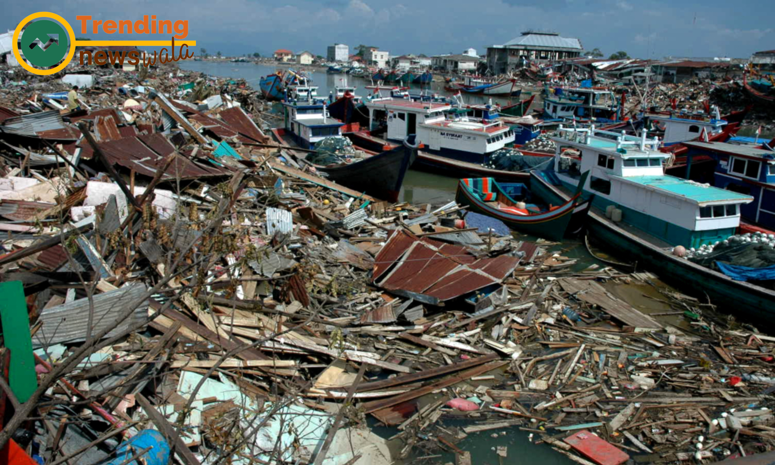
The 1833 Sumatra earthquake
The 1833 Sumatra earthquake, with an estimated magnitude of 8.8, triggered a massive tsunami that affected coastal areas from Indonesia to the east coast of Africa. The tsunami waves, reaching as far as the Caribbean, resulted in significant loss of life and property.
In the intricate tapestry of seismic history, the 1833 Sumatra earthquake emerges as a powerful and catastrophic event that unfolded in the Indian Ocean. Striking the Indonesian island of Sumatra, this earthquake not only unleashed formidable seismic forces but also triggered a devastating tsunami, leaving a lasting impact on the affected regions. In this article, we delve into the details of the 1833 Sumatra earthquake, examining its causes, consequences, and historical significance.
Tectonic Setting: The 1833 Sumatra earthquake was a result of the complex tectonic interactions in the region. Sumatra lies near the convergent boundary of the Indo-Australian and Eurasian tectonic plates, where intense subduction takes place, leading to the release of accumulated seismic stress.
Magnitude and Epicenter: This seismic event is estimated to have had a magnitude of approximately 8.8, making it a megathrust earthquake with substantial destructive potential. The epicenter was located off the west coast of Sumatra, near the subduction zone where the Indo-Australian Plate descends beneath the Eurasian Plate.
Tsunami Triggered by the Earthquake: What set the 1833 Sumatra earthquake apart was the colossal tsunami it triggered. The underwater displacement caused by the seismic activity generated immense waves that radiated across the Indian Ocean, affecting coastal regions as far away as the east coast of Africa.
Devastation Along Coastal Areas: Coastal areas of Sumatra bore the brunt of the earthquake and ensuing tsunami. Towns and villages along the shoreline were inundated, leading to widespread destruction and loss of life. The impact was particularly severe in areas close to the earthquake's epicenter.
Extended Reach of the Tsunami: The 1833 Sumatra earthquake had far-reaching consequences due to the tsunami it unleashed. Waves traveled across the Indian Ocean, affecting coastal regions in countries such as India, Sri Lanka, and even reaching the east coast of Africa. The tsunami's impact was felt thousands of miles away from the earthquake's epicenter.
Casualties and Destruction: The human toll of the 1833 Sumatra earthquake and tsunami was substantial. Exact figures are challenging to ascertain, but historical records estimate tens of thousands of casualties across the affected regions. Coastal settlements were decimated, and the maritime infrastructure faced extensive damage.
Scientific and Historical Documentation: The 1833 Sumatra earthquake holds significance in both scientific and historical contexts. It is extensively documented in historical records and scientific studies, providing valuable insights into the seismic dynamics of the region during the 19th century.
Impact on Tsunami Research: The devastating consequences of the tsunami triggered by the 1833 earthquake contributed to early research and understanding of tsunami propagation. Lessons learned from this event have informed modern efforts in tsunami warning systems and coastal preparedness.
Cultural and Societal Impacts: The 1833 Sumatra earthquake left an enduring mark on the affected communities, influencing cultural narratives and societal resilience. The tales of survival and reconstruction became woven into the fabric of local histories, emphasizing the human spirit's ability to endure and rebuild in the aftermath of natural disasters.
Modern-Day Considerations: Reflecting on the 1833 Sumatra earthquake is not only an exercise in historical exploration but also a reminder of the Earth's dynamic nature and the potential for far-reaching consequences. In an era of advanced scientific understanding, this seismic event serves as a crucial reference point for assessing contemporary seismic risks and mitigating the impact of future events.
The 1833 Sumatra earthquake and its ensuing tsunami stand as a testament to the immense power of nature to shape landscapes and human destinies. Beyond the immediate devastation, this seismic event has left an enduring legacy in scientific research, cultural narratives, and the collective memory of communities along the shores of the Indian Ocean. As we unravel the pages of history, the 1833 Sumatra earthquake serves as a poignant reminder of the interconnectedness of the Earth's geophysical processes and the need for ongoing efforts to understand, prepare for, and mitigate the impact of seismic events.
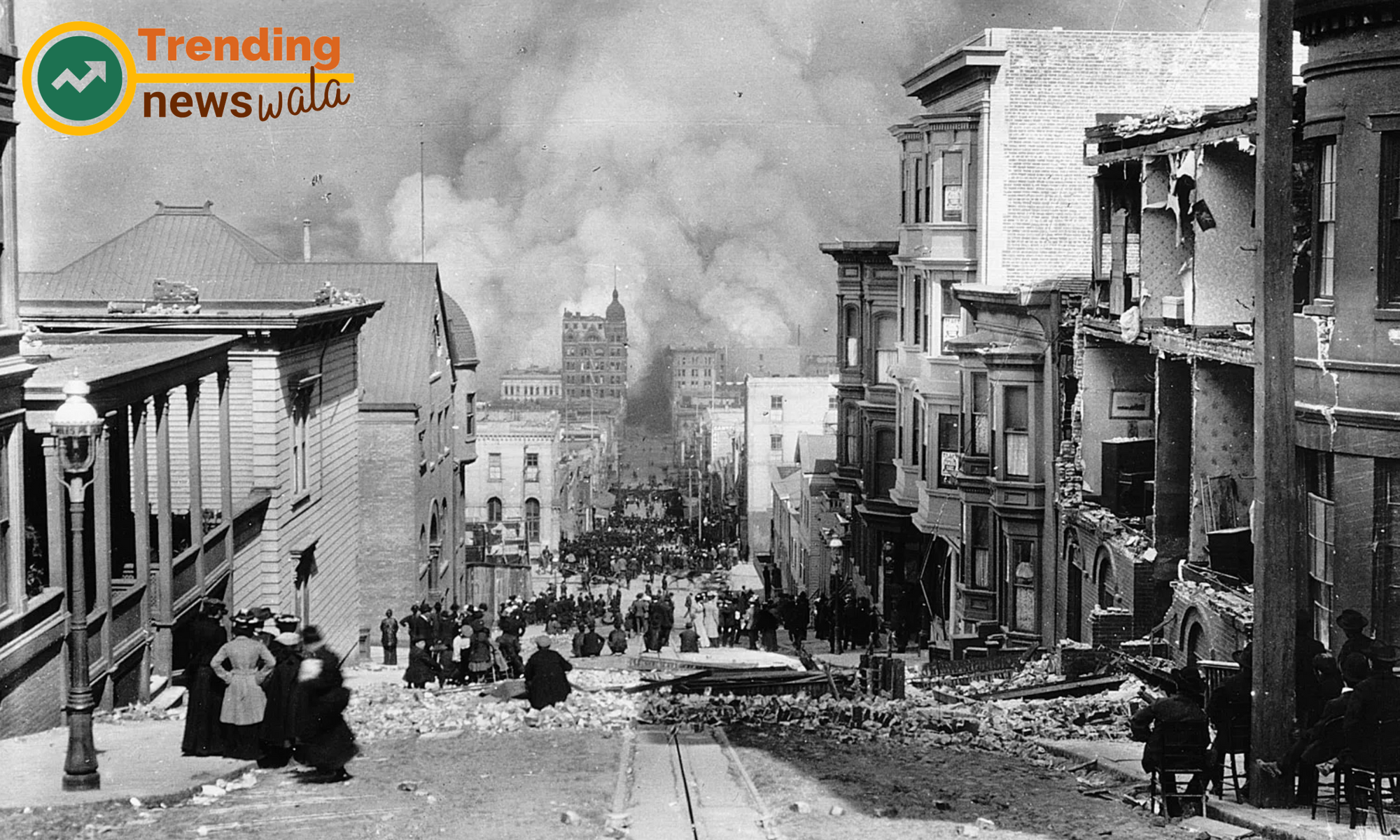
The 1906 San Francisco earthquake
The 1906 San Francisco earthquake, with a magnitude of 7.8, remains one of the most infamous seismic events in American history. The quake and subsequent fires resulted in widespread devastation in San Francisco, leaving over 3,000 people dead and large parts of the city in ruins.
In the early hours of April 18, 1906, the city of San Francisco experienced a seismic cataclysm that would forever alter its skyline and reshape the lives of its residents. The 1906 San Francisco earthquake remains etched in history as one of the most devastating natural disasters in the United States. In this article, we delve into the details of the earthquake, exploring its causes, the immediate aftermath, and its enduring impact on the city and its people.
Tectonic Forces Unleashed: The seismic drama unfolded along the infamous San Andreas Fault, where the Pacific and North American tectonic plates grind against each other. The pent-up energy released in the early morning hours led to a massive rupture, resulting in a significant earthquake.
Magnitude and Epicenter: The 1906 San Francisco earthquake is estimated to have had a magnitude of 7.8, making it a formidable seismic event. The epicenter was situated off the coast of Northern California, near the city of San Francisco.
Devastation Strikes: The earthquake struck at 5:12 a.m., catching the city in the grip of darkness. The initial seismic shock was followed by a series of aftershocks, compounding the chaos. However, the true extent of the disaster was yet to unfold as a more destructive force awaited – the fires that would ravage the city.
Fires Ravage the City: The earthquake ruptured gas lines, and the ensuing fires, fueled by broken gas mains, quickly spread through the city. Fanned by strong winds, the fires raged for days, consuming large swathes of San Francisco. Attempts to control the inferno were hampered by a destroyed water supply infrastructure.
Widespread Destruction: The combined impact of the earthquake and subsequent fires resulted in widespread destruction. Over 28,000 buildings were reduced to rubble, leaving more than half of the city's population homeless. The iconic cityscape, including landmarks like City Hall and the Palace Hotel, lay in ruins.
Human Toll: The human toll was profound. Official estimates suggest that over 3,000 people lost their lives, although the true number may have been higher. Many of the casualties were attributed to collapsing buildings, while others succumbed to the fires or perished in the chaos that ensued.
Displacement and Tent Cities: With much of the city in ruins, survivors faced displacement and sought refuge in makeshift tent cities. These temporary settlements, scattered across parks and open spaces, became a poignant symbol of resilience as the city embarked on the arduous task of rebuilding.
Reconstruction Efforts: The aftermath of the 1906 San Francisco earthquake marked the beginning of one of the most ambitious reconstruction efforts in American history. The city, determined to rise from the ashes, initiated a comprehensive rebuilding plan that included seismic retrofitting and improved urban planning.
Legacy of Resilience: The resilience displayed by the people of San Francisco in the wake of the 1906 earthquake has become a defining aspect of the city's identity. The disaster, rather than breaking the spirit of the community, served as a catalyst for innovation, urban development, and advancements in earthquake preparedness.
Modern-Day Preparedness: The legacy of the 1906 San Francisco earthquake is evident in the city's commitment to earthquake preparedness. Building codes, retrofitting initiatives, and emergency response protocols have been implemented to mitigate the impact of future seismic events.
The 1906 San Francisco earthquake stands as a pivotal moment in the city's history, a seismic rupture that tested the mettle of its residents and spurred unprecedented resilience. As San Francisco transformed from a city in ruins to a beacon of rebirth, the echoes of that fateful day continue to reverberate through the streets and skyscrapers. The story of the 1906 earthquake serves as a poignant reminder of both the destructive power of nature and the unwavering human spirit that rises from the ashes to rebuild, creating a legacy that endures through time.
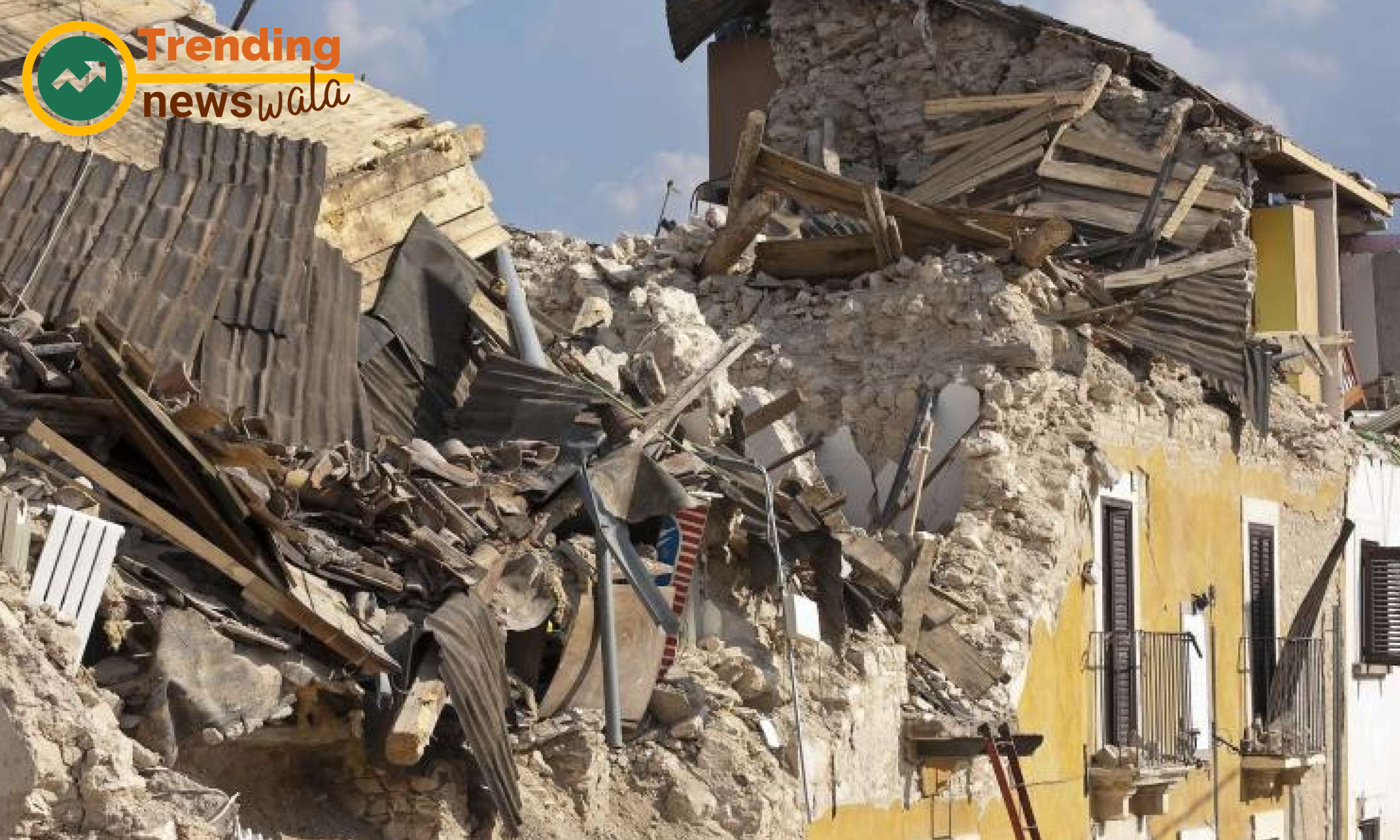
The 1976 earthquake measured
Striking the city of Tangshan in Hebei province, China, the 1976 earthquake measured 7.5 in magnitude and resulted in catastrophic consequences. The death toll is estimated to be between 242,000 and 655,000, making it one of the deadliest earthquakes of the 20th century.
In the early hours of April 18, 1906, the city of San Francisco experienced a seismic cataclysm that would forever alter its skyline and reshape the lives of its residents. The 1906 San Francisco earthquake remains etched in history as one of the most devastating natural disasters in the United States. In this article, we delve into the details of the earthquake, exploring its causes, the immediate aftermath, and its enduring impact on the city and its people.
Tectonic Forces Unleashed: The seismic drama unfolded along the infamous San Andreas Fault, where the Pacific and North American tectonic plates grind against each other. The pent-up energy released in the early morning hours led to a massive rupture, resulting in a significant earthquake.
Magnitude and Epicenter: The 1906 San Francisco earthquake is estimated to have had a magnitude of 7.8, making it a formidable seismic event. The epicenter was situated off the coast of Northern California, near the city of San Francisco.
Devastation Strikes: The earthquake struck at 5:12 a.m., catching the city in the grip of darkness. The initial seismic shock was followed by a series of aftershocks, compounding the chaos. However, the true extent of the disaster was yet to unfold as a more destructive force awaited – the fires that would ravage the city.
Fires Ravage the City: The earthquake ruptured gas lines, and the ensuing fires, fueled by broken gas mains, quickly spread through the city. Fanned by strong winds, the fires raged for days, consuming large swathes of San Francisco. Attempts to control the inferno were hampered by a destroyed water supply infrastructure.
Widespread Destruction: The combined impact of the earthquake and subsequent fires resulted in widespread destruction. Over 28,000 buildings were reduced to rubble, leaving more than half of the city's population homeless. The iconic cityscape, including landmarks like City Hall and the Palace Hotel, lay in ruins.
Human Toll: The human toll was profound. Official estimates suggest that over 3,000 people lost their lives, although the true number may have been higher. Many of the casualties were attributed to collapsing buildings, while others succumbed to the fires or perished in the chaos that ensued.
Displacement and Tent Cities: With much of the city in ruins, survivors faced displacement and sought refuge in makeshift tent cities. These temporary settlements, scattered across parks and open spaces, became a poignant symbol of resilience as the city embarked on the arduous task of rebuilding.
Reconstruction Efforts: The aftermath of the 1906 San Francisco earthquake marked the beginning of one of the most ambitious reconstruction efforts in American history. The city, determined to rise from the ashes, initiated a comprehensive rebuilding plan that included seismic retrofitting and improved urban planning.
Legacy of Resilience: The resilience displayed by the people of San Francisco in the wake of the 1906 earthquake has become a defining aspect of the city's identity. The disaster, rather than breaking the spirit of the community, served as a catalyst for innovation, urban development, and advancements in earthquake preparedness.
Modern-Day Preparedness: The legacy of the 1906 San Francisco earthquake is evident in the city's commitment to earthquake preparedness. Building codes, retrofitting initiatives, and emergency response protocols have been implemented to mitigate the impact of future seismic events.
The 1906 San Francisco earthquake stands as a pivotal moment in the city's history, a seismic rupture that tested the mettle of its residents and spurred unprecedented resilience. As San Francisco transformed from a city in ruins to a beacon of rebirth, the echoes of that fateful day continue to reverberate through the streets and skyscrapers. The story of the 1906 earthquake serves as a poignant reminder of both the destructive power of nature and the unwavering human spirit that rises from the ashes to rebuild, creating a legacy that endures through time.
The 2004 Indian Ocean earthquake
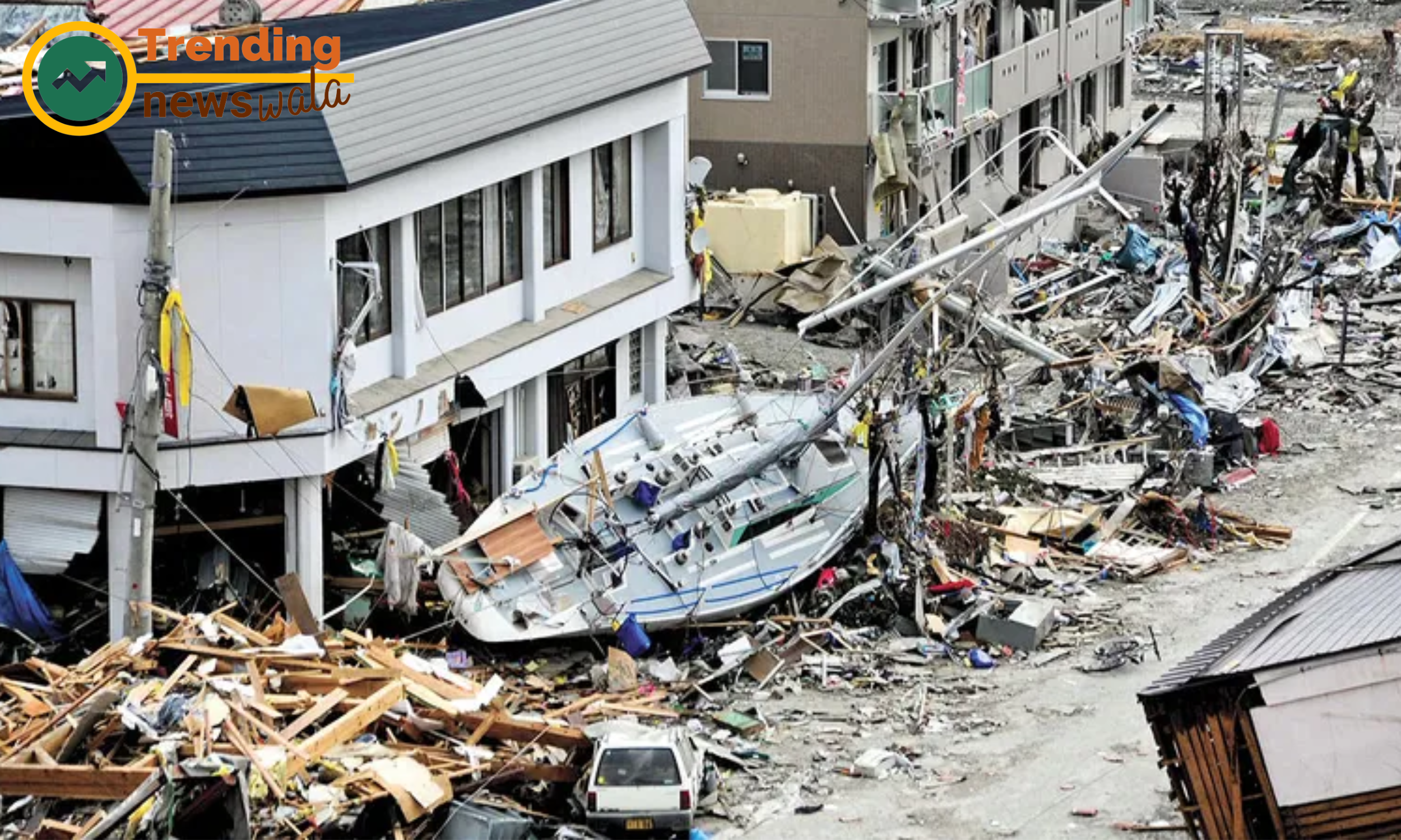
With a magnitude of 9.1-9.3, the 2004 Indian Ocean earthquake remains one of the most powerful recorded earthquakes in history. Triggering a devastating tsunami, the disaster affected multiple countries, claiming over 230,000 lives and causing widespread destruction.
On the morning of December 26, 2004, a colossal seismic event beneath the Indian Ocean unleashed one of the deadliest natural disasters in recorded history – the 2004 Indian Ocean earthquake and tsunami. Striking without warning, the disaster left a trail of destruction across multiple countries, claiming hundreds of thousands of lives and prompting an unprecedented international humanitarian response. In this article, we explore the details of this catastrophic event, its causes, immediate aftermath, and the enduring impact on the affected regions.
Tectonic Underpinnings: The seismic turmoil originated along the subduction zone where the Indian Plate converges with the Burma Plate. The sudden release of energy from the tectonic plates colliding beneath the ocean floor led to a megathrust earthquake of colossal proportions.
Magnitudinal Might: The 2004 Indian Ocean earthquake registered a magnitude of 9.1–9.3, making it one of the most powerful earthquakes ever recorded. The epicenter was situated off the west coast of Northern Sumatra, Indonesia.
Tsunami Unleashed: What followed the seismic upheaval was equally devastating – a tsunami of catastrophic proportions. The underwater quake displaced colossal volumes of water, generating a series of tsunami waves that radiated across the Indian Ocean basin.
Global Impact: The reach of the tsunami was truly global, affecting countries surrounding the Indian Ocean. Coastal regions in Indonesia, Thailand, Sri Lanka, India, the Maldives, and as far away as East Africa experienced the relentless force of the waves.
Human Toll: The human toll of the 2004 Indian Ocean tsunami was staggering. The official death toll surpassed 230,000, with some estimates suggesting numbers closer to 300,000. Entire communities were decimated, and the loss of life included locals and tourists alike.
Widespread Destruction: Coastal areas faced widespread destruction as the tsunami waves inundated cities, towns, and villages. Infrastructure, including homes, hotels, and vital services, was swept away, leaving behind a landscape scarred by the forces of nature.
Immediate Aftermath: In the immediate aftermath, affected regions grappled with the scale of the disaster. Overwhelmed by the sheer magnitude of destruction, local authorities struggled to provide emergency aid, and communities were left in a state of shock and despair.
International Response: The unprecedented scale of the disaster prompted a swift and extensive international humanitarian response. Nations, organizations, and individuals rallied together to provide emergency relief, medical assistance, and financial aid to the affected areas.
Rebuilding Lives: The aftermath of the 2004 Indian Ocean tsunami marked the beginning of a monumental effort to rebuild shattered lives and communities. Reconstruction initiatives focused on not only physical infrastructure but also addressing the emotional and psychological trauma endured by survivors.
Legacy of Preparedness: The 2004 Indian Ocean earthquake and tsunami left a lasting legacy in terms of global disaster preparedness. Efforts were intensified to enhance early warning systems, improve seismic monitoring, and establish protocols for rapid response to mitigate the impact of future tsunamis.
The 2004 Indian Ocean earthquake and tsunami stand as a somber reminder of the unpredictable and devastating forces that nature can unleash. The unprecedented loss of life and widespread destruction sparked a global outpouring of compassion and aid. As affected regions continue to rebuild, the legacy of the disaster lives on in the collective memory of those who witnessed its fury, and in the commitment to fostering global cooperation in disaster preparedness and response. The 2004 Indian Ocean tsunami serves as a profound testament to the resilience of the human spirit in the face of unparalleled tragedy.
2010 earthquake in Haiti
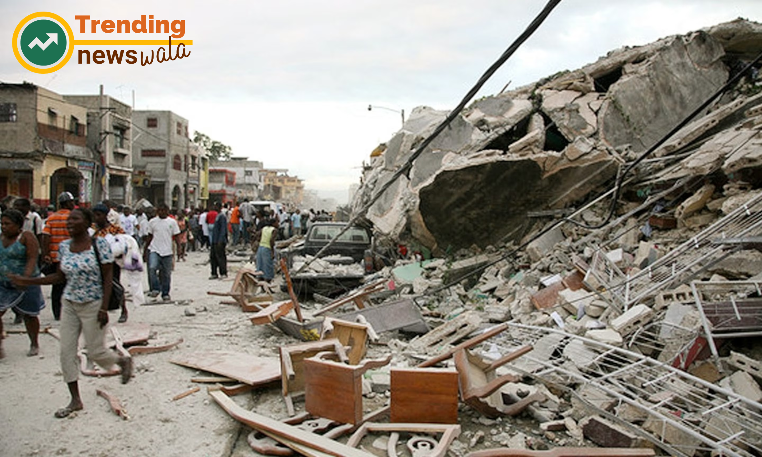
The 2010 earthquake in Haiti, with a magnitude of 7.0, wreaked havoc on the capital city, Port-au-Prince. The earthquake, compounded by inadequate infrastructure, resulted in approximately 230,000 casualties and left millions in need of humanitarian aid.
On January 12, 2010, the impoverished nation of Haiti experienced a seismic catastrophe that reverberated through its capital, Port-au-Prince, and beyond. The 2010 Haiti earthquake, with a magnitude of 7.0, left a trail of devastation, claiming lives, shattering infrastructure, and plunging the country into a humanitarian crisis. In this article, we delve into the details of this tragic event, examining its causes, immediate aftermath, and the ongoing efforts to rebuild and foster resilience.
Tectonic Unrest: The seismic upheaval in Haiti was triggered by the movement along the Enriquillo-Plantain Garden Fault, where the Caribbean and North American tectonic plates interact. The accumulated stress was released abruptly, causing the ground to shake violently.
Epicenter and Magnitude: The epicenter of the 2010 Haiti earthquake was located just 16 miles west of Port-au-Prince. With a magnitude of 7.0, the quake struck close to the surface, amplifying its impact on the densely populated and poorly constructed urban areas.
Devastating Impact: The earthquake's impact was immediate and catastrophic. The poorly constructed buildings in Port-au-Prince and surrounding areas crumbled, trapping residents under the rubble. Infrastructure, including hospitals, schools, and government buildings, suffered extensive damage, exacerbating the challenges of the unfolding humanitarian crisis.
Human Toll: The human toll of the 2010 Haiti earthquake was staggering. Official estimates suggest that over 230,000 people lost their lives, and countless others were injured. The earthquake displaced more than a million Haitians, rendering them homeless and vulnerable.
Humanitarian Crisis Unfolds: In the aftermath of the earthquake, Haiti faced a severe humanitarian crisis. The destruction of critical infrastructure hampered rescue and relief efforts, leaving survivors without access to medical care, clean water, and essential supplies.
Global Response: The scale of the disaster prompted an outpouring of international support. Countries, organizations, and individuals rallied to provide emergency aid, medical assistance, and financial support to help Haiti cope with the immediate aftermath and initiate the long process of rebuilding.
Challenges in Relief Efforts: Despite the global response, relief efforts faced numerous challenges. Poorly coordinated aid distribution, logistical hurdles, and the overwhelming scale of the disaster complicated the delivery of assistance to those in need.
Reconstruction Initiatives: The rebuilding process in Haiti has been slow and arduous. International organizations, non-governmental entities, and the Haitian government embarked on ambitious reconstruction initiatives, focusing on rebuilding infrastructure, restoring essential services, and creating sustainable solutions for the future.
Resilience and Community Spirit: In the face of immense adversity, the people of Haiti have demonstrated remarkable resilience and a strong sense of community. Local initiatives, grassroots organizations, and the strength of the human spirit have played crucial roles in the ongoing recovery efforts.
Ongoing Challenges and Future Prospects: Challenges persist in Haiti, including political instability, economic struggles, and vulnerability to natural disasters. However, ongoing efforts continue to focus on sustainable development, disaster preparedness, and empowering local communities to build a more resilient future.
The 2010 Haiti earthquake remains a poignant chapter in the nation's history, marking a moment of profound loss and enduring resilience. The global response highlighted the interconnectedness of humanity in the face of tragedy. As Haiti continues its journey toward recovery, the lessons learned from the earthquake underscore the importance of international solidarity, sustainable development, and the unwavering human capacity to rebuild and overcome even the most devastating challenges.
1970 earthquake in Peru
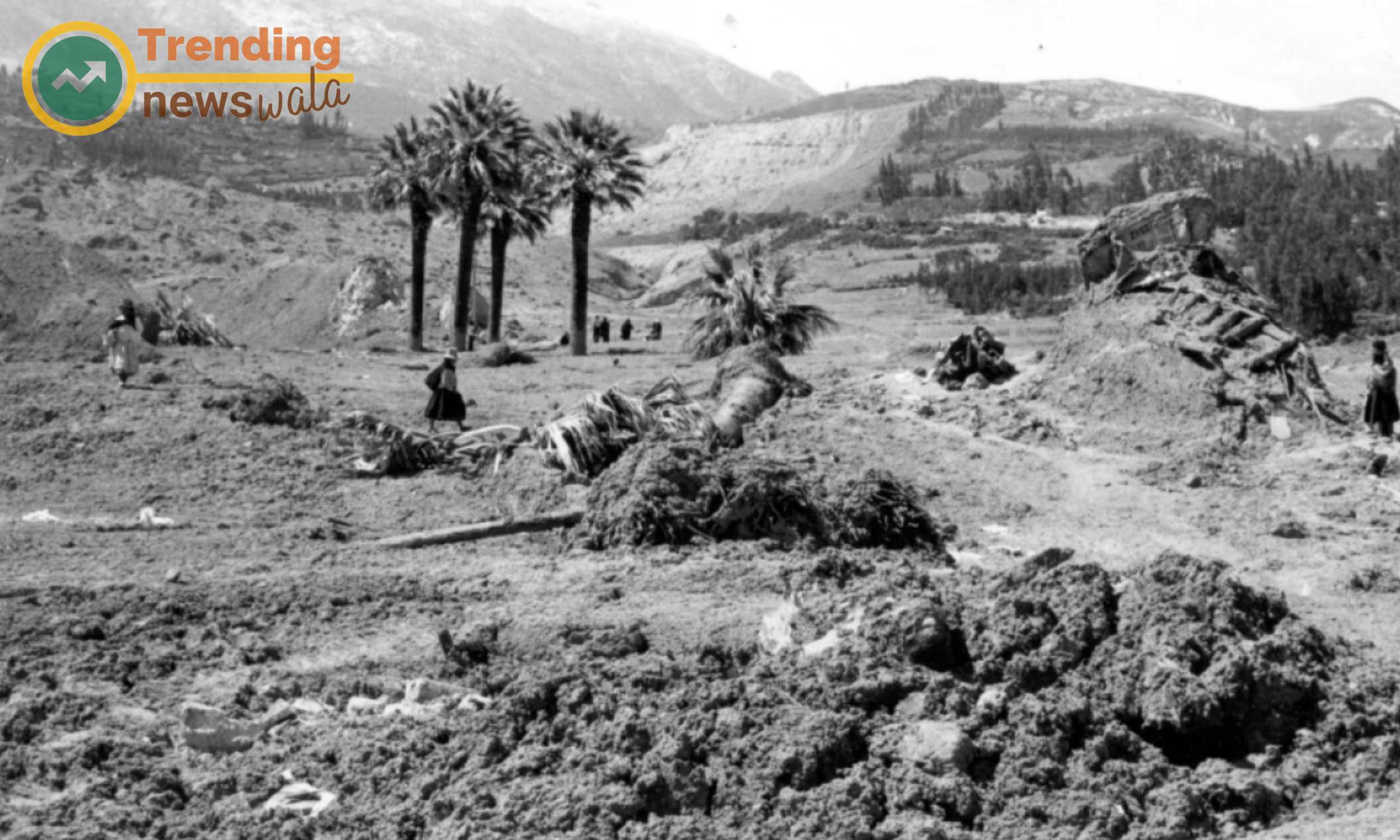
The 1970 earthquake in Peru, with a magnitude of 7.9, struck densely populated areas, including the city of Chimbote. The earthquake and ensuing landslide caused extensive damage, resulting in over 66,000 fatalities and leaving many more homeless.
On May 31, 1970, a seismic tremor of unprecedented magnitude shook the Peruvian region, leaving in its wake one of the deadliest natural disasters in the country's history. The 1970 Peru earthquake, with a magnitude of 7.9, not only inflicted widespread destruction on infrastructure but also triggered catastrophic landslides, forever altering the landscape and claiming the lives of tens of thousands of people. In this article, we delve into the details of this seismic tragedy, exploring its causes, immediate consequences, and the resilience of the affected communities.
Tectonic Turmoil: The seismic events of 1970 were set in motion by the subduction of the Nazca Plate beneath the South American Plate, a tectonic process occurring along the Pacific Ring of Fire. The accumulated stress was suddenly released, resulting in a powerful earthquake.
Epicenter and Magnitude: The epicenter of the earthquake was situated near Chimbote, a coastal city in northern Peru. With a magnitude of 7.9, the quake struck a densely populated area, amplifying its impact on communities already grappling with poverty and inadequate infrastructure.
Devastating Landslides: What set the 1970 Peru earthquake apart was the series of massive landslides it triggered, particularly in the Cordillera Blanca mountain range. These landslides, exacerbated by heavy rainfall, buried entire villages under tons of debris, compounding the destruction caused by the earthquake itself.
Human Toll: The human toll of the disaster was staggering. The official death toll surpassed 66,000, making it one of the deadliest earthquakes in the 20th century. The majority of the casualties resulted from the landslides, which buried communities under mud and rock, leaving little chance for escape.
Widespread Destruction: The earthquake and landslides caused widespread destruction across the affected region. Towns and villages were decimated, and critical infrastructure, including roads and bridges, was obliterated. The scale of the disaster overwhelmed local authorities, hindering immediate response efforts.
Impact on Chimbote: Chimbote, one of the largest cities near the earthquake's epicenter, faced severe consequences. The city's infrastructure, including its port and industrial facilities, suffered extensive damage. The loss of life and economic devastation had profound and lasting implications for the community.
Challenges in Emergency Response: The sheer scale of the disaster posed immense challenges for emergency response efforts. The remote and mountainous terrain, coupled with the destruction of infrastructure, hampered the timely delivery of aid and medical assistance to those in need.
International Aid and Solidarity: In the aftermath of the 1970 Peru earthquake, the international community rallied to provide support and aid. Countries, organizations, and individuals contributed resources, emergency relief, and assistance in rebuilding efforts, emphasizing the interconnectedness of global solidarity in times of crisis.
Reconstruction and Resilience: The reconstruction efforts that followed focused on rebuilding infrastructure, homes, and communities. The resilience of the affected population, coupled with international assistance, played a crucial role in the gradual recovery and reconstruction of the region.
Legacy and Lessons Learned: The 1970 Peru earthquake left a lasting legacy, underscoring the vulnerability of communities in earthquake-prone regions and the need for robust infrastructure and disaster preparedness. The lessons learned from this tragic event continue to influence seismic risk mitigation strategies in Peru and other earthquake-prone areas.
The 1970 Peru earthquake stands as a stark reminder of the unpredictable and devastating forces that nature can unleash upon communities. The resilience of the affected population and the international response highlight the importance of preparedness, cooperation, and solidarity in the face of seismic tragedies. As Peru continues to navigate the complexities of living in a seismically active region, the memory of the 1970 earthquake serves as a guiding force in shaping strategies for sustainable development and disaster resilience.
2011 Tohoku Earthquake, Japan
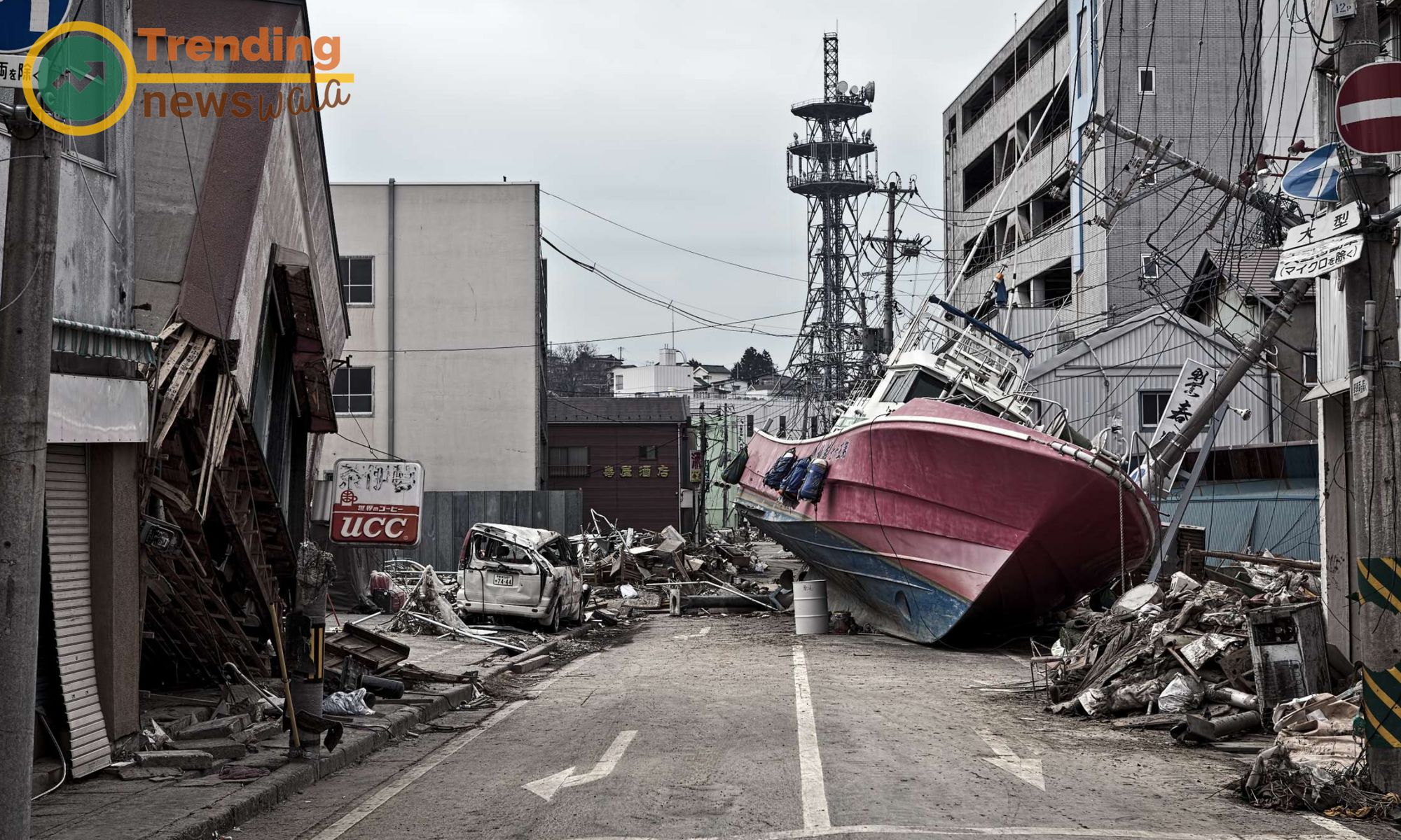
The 2011 Tohoku earthquake, with a magnitude of 9.0, triggered a massive tsunami that struck the northeastern coast of Japan. The disaster led to the Fukushima Daiichi nuclear disaster and claimed over 15,000 lives, making it one of the most devastating earthquakes in recent history.
On March 11, 2011, the Pacific Rim was jolted by a seismic event that would leave an indelible mark on the nation of Japan. The 2011 Tohoku earthquake, with a magnitude of 9.0, triggered a devastating tsunami, leading to widespread destruction along the northeastern coast of Japan. This catastrophic event not only tested the nation's preparedness but also highlighted the strength and resilience of the Japanese people in the face of unparalleled tragedy. In this article, we delve into the details of the 2011 Tohoku earthquake, examining its causes, immediate aftermath, and the ongoing recovery efforts.
Undersea Tremors: The 2011 Tohoku earthquake was a result of the Pacific Plate's subduction beneath the North American Plate off the eastern coast of Japan. The sudden release of energy led to a megathrust earthquake, setting in motion a sequence of events that would unfold with devastating consequences.
Epicenter and Tsunami: The epicenter of the earthquake was located approximately 70 kilometers east of the Oshika Peninsula in Tohoku. The seismic activity displaced colossal volumes of water in the Pacific Ocean, giving rise to a powerful tsunami that would inundate the coastal regions of Japan.
Magnitude and Scale: With a magnitude of 9.0, the Tohoku earthquake ranks as one of the most powerful ever recorded. The resulting tsunami, reaching heights of over 40 meters in some areas, crashed ashore, causing widespread destruction along a vast stretch of Japan's northeastern coastline.
Human Toll: The human toll of the disaster was profound. Official figures indicate that over 15,000 people lost their lives, and thousands more were reported missing. Entire communities were swept away, and the impact was felt far beyond the immediate coastal areas.
Fukushima Nuclear Disaster: The Tohoku earthquake also triggered a nuclear crisis at the Fukushima Daiichi Nuclear Power Plant. The tsunami inundated the plant, leading to meltdowns in three of its reactors and causing the release of radioactive materials. The Fukushima disaster added another layer of complexity to the humanitarian and environmental challenges faced by Japan.
Immediate Response and Rescue Efforts: In the immediate aftermath of the disaster, Japan launched an extensive search and rescue operation. Emergency response teams, both domestic and international, worked tirelessly to locate survivors, provide medical assistance, and offer support to the affected communities.
International Assistance: The global community rallied in support of Japan, offering financial aid, expertise, and humanitarian assistance. Countries and organizations worldwide contributed resources to aid in the recovery efforts and help Japan rebuild in the wake of such widespread devastation.
Rebuilding Lives and Infrastructure: The aftermath of the Tohoku earthquake witnessed an unprecedented effort to rebuild shattered lives and infrastructure. Reconstruction initiatives focused on constructing resilient buildings, restoring vital services, and implementing measures to enhance disaster preparedness and response.
Lessons Learned and Seismic Preparedness: The Tohoku earthquake prompted a reevaluation of Japan's seismic preparedness. The lessons learned from the disaster influenced changes in building codes, evacuation procedures, and early warning systems to better mitigate the impact of future earthquakes and tsunamis.
Ongoing Resilience: The resilience of the Japanese people has been a defining aspect of the post-earthquake narrative. Communities affected by the disaster have shown remarkable strength and determination in rebuilding their lives and creating a more resilient future.
The 2011 Tohoku earthquake and its aftermath stand as a testament to the capacity of nations and communities to recover from even the most devastating natural disasters. Japan's resilience, coupled with international solidarity, has transformed the tragedy into an opportunity for growth, learning, and fortifying the nation against future seismic challenges. As Japan continues to rebuild and foster resilience, the legacy of the 2011 Tohoku earthquake remains a powerful reminder of the human spirit's ability to rise from the rubble and build a better, more resilient tomorrow.
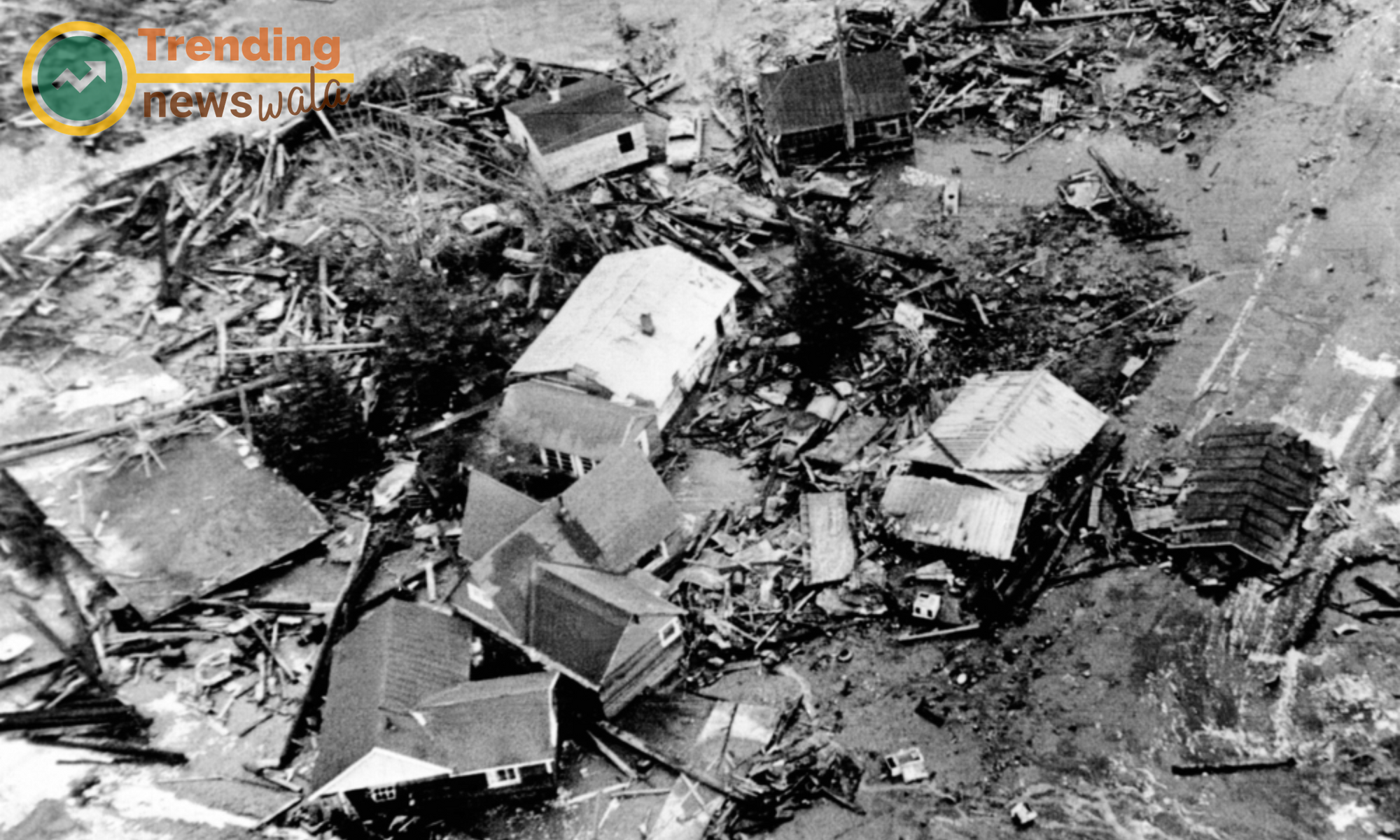
1964 Alaska Earthquake, United States
The 1964 Alaska earthquake, with a magnitude of 9.2, remains the most powerful earthquake recorded in North American history. The quake and ensuing tsunami affected Alaska, parts of Canada, and the west coast of the United States, causing extensive damage and loss of life.
On March 27, 1964, the tranquility of the Alaskan landscape was shattered by a colossal seismic event that would go on to reshape the state and leave an indelible mark on the seismic history of the United States. The 1964 Alaska earthquake, with a magnitude of 9.2, remains one of the most powerful earthquakes ever recorded globally. In this article, we delve into the details of this seismic milestone, exploring its causes, immediate aftermath, and the long-term impact on Alaska and the broader understanding of earthquake preparedness.
Tectonic Turmoil: The 1964 Alaska earthquake resulted from the subduction of the Pacific Plate beneath the North American Plate along the Aleutian Trench. The accumulated stress along the fault line was released in a megathrust earthquake, generating colossal seismic waves that reverberated across the region.
Epicenter and Magnitude: The epicenter of the earthquake was situated in the Prince William Sound region of Alaska, approximately 75 miles east of Anchorage. With a magnitude of 9.2, the earthquake ranks as the second most powerful ever recorded, surpassed only by the 1960 Chilean earthquake.
Seismic Sea Waves: In addition to the ground-shaking tremors, the 1964 Alaska earthquake triggered a series of tsunamis that propagated across the Pacific Ocean. These seismic sea waves caused devastation not only in Alaska but also as far away as California, Hawaii, and Japan.
Human Toll and Destruction: The 1964 Alaska earthquake resulted in a relatively low human toll, with around 131 reported fatalities. However, the destruction of infrastructure was widespread. Coastal communities faced severe damage due to the tsunamis, while areas near the epicenter experienced ground shaking that caused buildings, bridges, and roads to crumble.
Anchorage in Turmoil: Anchorage, Alaska's largest city, bore the brunt of the earthquake's impact. The ground shaking and subsequent liquefaction of the soil led to significant damage to buildings and infrastructure. The destruction prompted the city to undergo extensive reconstruction efforts in the years that followed.
Tsunami Devastation: The tsunamis generated by the earthquake caused substantial destruction along the Alaskan coastline. Waves reached heights of over 200 feet in some areas, leaving behind a trail of devastation that included the submersion of entire communities and infrastructure.
Emergency Response and Reconstruction: The emergency response to the 1964 Alaska earthquake was a testament to the resilience of the Alaskan people. Swift action was taken to provide aid, evacuate affected areas, and initiate reconstruction efforts. The federal government played a crucial role in allocating resources for the rebuilding of infrastructure and communities.
Scientific Advancements: The seismic data and lessons learned from the 1964 Alaska earthquake significantly advanced the understanding of megathrust earthquakes and their potential impact. This event paved the way for improvements in earthquake monitoring, early warning systems, and the development of seismic-resistant building codes.
Legacy in Earthquake Preparedness: The 1964 Alaska earthquake left an enduring legacy in the realm of earthquake preparedness. The lessons learned have influenced seismic risk mitigation strategies not only in Alaska but also globally. The event underscored the importance of robust infrastructure, emergency response planning, and community resilience.
Alaska's Ongoing Seismic Vigilance: Today, Alaska remains one of the most seismically active regions on Earth. The legacy of the 1964 earthquake continues to shape the state's approach to earthquake preparedness, with ongoing efforts to enhance infrastructure resilience, public awareness, and emergency response capabilities.
The 1964 Alaska earthquake stands as a pivotal moment in seismic history, a seismic awakening that prompted advancements in earthquake science and resilience. The enduring legacy of this event serves as a reminder of the unpredictable forces that shape the Earth's crust and the importance of ongoing efforts to mitigate the impact of future seismic events. As Alaska continues to navigate its seismic reality, the lessons learned from the 1964 earthquake remain a guiding beacon in the state's journey toward greater resilience and preparedness.
2015 Nepal Earthquake
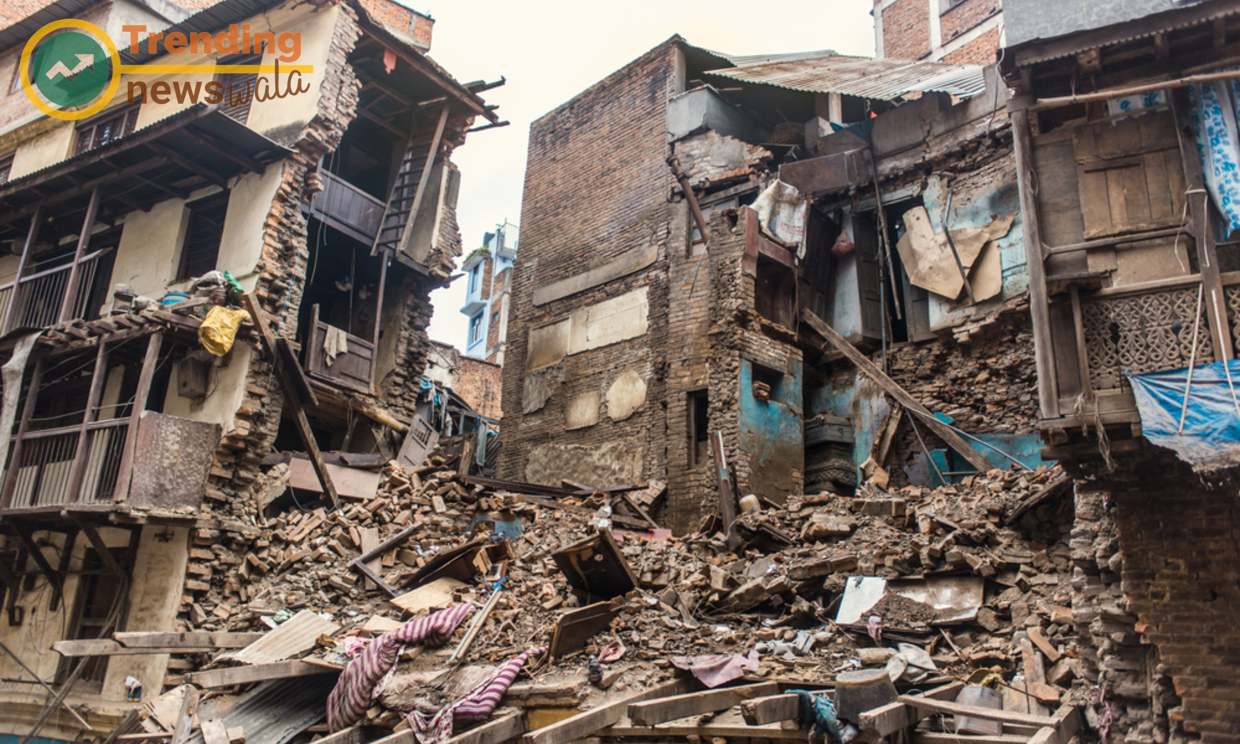
Striking near the capital, Kathmandu, the 2015 earthquake in Nepal had a magnitude of 7.8. The quake, along with subsequent aftershocks, resulted in widespread destruction, claiming over 8,000 lives and causing significant damage to cultural heritage sites.
On April 25, 2015, Nepal, nestled in the heart of the Himalayas, faced a seismic upheaval that would leave an indelible mark on its landscape and people. The 2015 Nepal earthquake, with a magnitude of 7.8, brought about widespread devastation, claiming lives, demolishing heritage sites, and triggering a humanitarian crisis. In this article, we reflect on the details of this catastrophic event, exploring its causes, immediate aftermath, and the ongoing efforts to rebuild a resilient Nepal.
Himalayan Tectonic Forces: Nepal, situated along the convergence of the Indian and Eurasian tectonic plates, is no stranger to seismic activity. The 2015 earthquake was a result of the ongoing collision between these plates, causing a rupture along the Main Himalayan Thrust fault.
Epicenter and Magnitude: The earthquake's epicenter was near the Gorkha district, northwest of the capital, Kathmandu. With a magnitude of 7.8, the quake unleashed powerful tremors that were felt not only in Nepal but also in neighboring countries like India, China, and Bangladesh.
Human Toll: The human toll of the 2015 Nepal earthquake was devastating. Official figures estimate that over 8,000 people lost their lives, with tens of thousands more injured. The earthquake left countless families mourning the loss of loved ones and grappling with the physical and emotional scars left in its wake.
Heritage in Ruins: Nepal's rich cultural heritage suffered a severe blow as many historic structures, including UNESCO World Heritage sites like the Dharahara tower and Patan Durbar Square, were reduced to rubble. Centuries-old temples, monuments, and cultural artifacts were lost, robbing Nepal of its architectural treasures.
Humanitarian Crisis Unfolds: The earthquake triggered a complex humanitarian crisis as survivors faced the immediate challenges of shelter, clean water, and medical assistance. Remote and mountainous terrain compounded the difficulties in delivering aid to those in need, especially in isolated villages.
Global Response: The international community rallied to support Nepal in its hour of need. Countries, non-governmental organizations, and individuals worldwide contributed financial aid, emergency relief, and personnel to assist in search and rescue operations and provide essential services to survivors.
Reconstruction Challenges: The reconstruction effort in Nepal faced formidable challenges. Limited resources, political complexities, and the sheer scale of destruction hindered the swift rebuilding of homes, infrastructure, and cultural landmarks. The need for sustainable and earthquake-resistant construction became paramount.
Resilience and Community Spirit: The resilience and community spirit of the Nepalese people played a crucial role in the recovery process. Communities came together to support one another, and local initiatives played a significant part in rebuilding lives and infrastructure.
Ongoing Reconstruction: In the years following the earthquake, Nepal embarked on a journey of reconstruction. Efforts focused on not only restoring what was lost but also building resilience against future seismic events. Reconstruction initiatives included earthquake-resistant infrastructure, improved urban planning, and heritage restoration.
Lessons Learned and Future Preparedness: The 2015 Nepal earthquake served as a poignant reminder of the vulnerability of earthquake-prone regions and the importance of disaster preparedness. The lessons learned have influenced building codes, early warning systems, and community-based initiatives to enhance resilience and reduce the impact of future seismic events.
The scars of the 2015 Nepal earthquake run deep, marking a chapter in the nation's history of both loss and resilience. As Nepal continues its journey of reconstruction, the earthquake serves as a catalyst for positive change – fostering community resilience, inspiring global solidarity, and prompting a reevaluation of seismic preparedness. The memory of the earthquake remains etched in the collective consciousness of the Nepalese people, a reminder of the strength that emerges from the rubble and the enduring spirit that propels a nation toward a more resilient and hopeful future.

Faq For Top Worst Earthquakes
The 1960 Valdivia earthquake in Chile holds the record as the most powerful earthquake ever recorded, with a magnitude of 9.5.
The 2004 Indian Ocean earthquake and tsunami resulted in a staggering human toll, with an official death toll exceeding 230,000. Some estimates suggest numbers closer to 300,000.
The 1970 Peru earthquake triggered massive landslides, particularly in the Cordillera Blanca mountain range, causing significant destruction and contributing to the high death toll.
The 2010 Haiti earthquake was devastating, claiming over 230,000 lives and causing widespread destruction of infrastructure. It also led to a severe humanitarian crisis.
The 1964 Alaska earthquake prompted advancements in earthquake science, influencing seismic monitoring, early warning systems, and the development of seismic-resistant building codes.
The 2011 Tohoku earthquake led to the Fukushima Daiichi Nuclear Power Plant disaster, with meltdowns in three reactors and the release of radioactive materials, adding a complex layer to the humanitarian and environmental challenges.
The 1964 Alaska earthquake significantly influenced seismic risk mitigation strategies globally, contributing to improvements in earthquake monitoring, early warning systems, and seismic-resistant building practices.
The 2015 Nepal earthquake resulted in the destruction of numerous historic structures, including UNESCO World Heritage sites, causing a significant loss of cultural heritage and architectural treasures.
The 2004 Indian Ocean earthquake is infamous for triggering powerful tsunamis that affected countries surrounding the Indian Ocean, leading to widespread devastation and loss of life.
The 2015 Nepal earthquake highlighted the importance of sustainable and earthquake-resistant construction, influencing reconstruction initiatives that focused on resilience against future seismic events.
Writer and content creator
Log in to share your thoughts and engage with other readers.